 |
 |
|||||||||||||||||||||
|
||||||||||||||||||||||
Arizona eBird Gaps
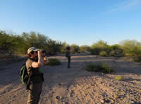 |
| photo by Eric Hough |
Welcome to the AZFO eBird Gaps project! Arizona Field Ornithologists (AZFO) is a non-profit organization dedicated to increasing the knowledge of Arizona's birds. One of our main focuses has always been exploring areas of Arizona where we lack the full picture of the status and distribution birds. This project introduces a new way for birders to take part in this venture, by contributing their sightings to the global citizen science database, eBird.
Through the year, we will feature maps of different areas of the state lacking eBird data and will provide information on how to access these areas. This will include locations lacking data for particular seasons or months of the year, and highlight species that may occur there that haven't been found yet. Please see the sections below for information on how to participate and tips for preparing before going into the field.
Help us fill in the gaps in our knowledge of Arizona’s birds! To get a sense of the current eBird coverage in the state, check out this map (pdf) showing the current eBird points (through April 2020).
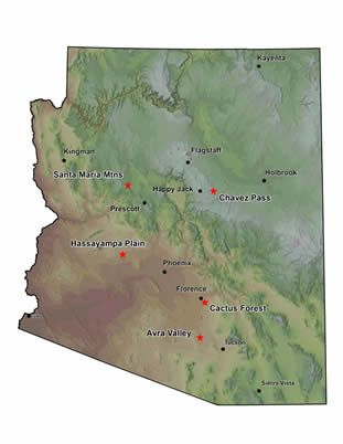
Featured Gaps
We will offer new maps every so often in the future and switch maps out to keep everyone interested and engaged! Below you will find the downloadable maps and access information for the five currently Featured Gaps, Avra Valley, Cactus Forest, Chavez Pass, Hassayampa Plain, and Santa Maria Mountains.
Avenza Maps - To download copies of any of the Featured Gaps maps (below) onto a mobile device, please go to your App Store or Play Store first and download the Avenza app. Please read these instructions on downloading and using the Avenza maps specific to the AZFO eBird Gaps project.
State Trust Lands - Please note, State Trust lands require a recreation permit, which are available for individuals, families, small and large groups. The individual permit is currently $15 per year and the family permit (2 adults, 2 children per family) is $20 per year, with an additional $1 processing fee for both types of permit. Permits can be purchased online on their permits page.
Avra Valley (Pima/Pinal Co.)
Description
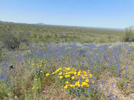
The Avra Valley is close to Tucson and situated between the western unit of Saguaro National Park in the Tucson Mountains, and Ironwood Forest National Monument in the Silverbell Mountains, and just south of the Santa Cruz Flats. Avra Valley is starting to see considerable suburban and rural development, which is removing and fragmenting desert-scrub habitat and species that depend on it. On top of this, part of the proposed Interstate-11 route will go right up the Avra Valley. Both the valley and the adjacent Ironwood Forest National Monument have limited eBird coverage, so focusing birders here will help us document the current desert bird populations and how their distribution changes over time with increasing urbanization. Species of concern for conservation to watch for in this area include Gilded Flicker, Elf Owl, Crested Caracara, and Bendire’s Thrasher. Migrant songbirds use vegetated desert washes, particularly in spring when mesquites, paloverdes, and ironwoods are in bloom. Watch for wintering sparrow flocks around shrubby edges of the desert and around farm fields, as well as raptors, larks, longspurs, and pipits in winter. If you encounter raptor nests or roost sites, please give the birds space, limit your time near them, and refrain from divulging their location to avoid disturbance to these sensitive nesting species.
Access Information
This area can be accessed from several exits off of Interstate-10 from Marana and west Tucson. The Friends of Ironwood Forest’s website provides directions for some different access routes. It is best to avoid dirt roads and low-lying areas during rain storms, as flash floods may occur and roads may be inaccessible, especially at the Santa Cruz River crossings. Respect private property rights and only bird from public roads when traveling through areas of private property. Refer to the above information on permits for accessing parcels of State Trust Land. Do not trespass onto the Tohono O’Odham tribal lands to the west. International trafficking of drugs and people may be encountered in southern Arizona, so use caution when traveling in remote places and consider traveling with one or more birding buddies. Please check out our “Be Prepared Before You Go” section above for other tips when visiting desert regions. See the above section regarding annual permits for recreating on State Trust Lands.
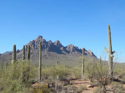
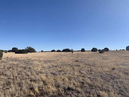
Cactus Forest (Pinal Co.)
Description
This area south and east of Florence contains some of the best remaining upland Sonoran Desert in the state, with tall groves of saguaros, paloverdes, acacias, and chollas. Desert washes with denser vegetation includes paloverdes, mesquites, and ironwoods, which likely funnel migrant songbirds. Large saguaro cacti may host cavity-nesting species and raptors, including Harris’s Hawk, Elf Owl, and Gilded Flicker. Species at the northern outskirts of their range in this area include Crested Caracara and Rufous-winged Sparrow. A species of conservation concern, Bendire’s Thrashers should be looked for in this area. Shrubby lowlands and desert washes may harbor raptors, sparrows, thrashers, and bluebirds in winter. Urban and rural human development is likely to continue along the Hwy. 79 corridor in the future, so it would be beneficial to document the area’s avifauna before habitat loss increases.
Access Information
Much of the accessible areas off of roads are on State Trust lands, so a permit is needed to recreate (see above for information on the Arizona State Land Department’s permits). Simply driving on roads through State Trust land does not require a permit, but technically you need one if you stop your vehicle at all, as the permit includes birdwatching, photography, and sight-seeing. Please respect and obey all private property signs.
Chavez Pass (Coconino Co.)
Description
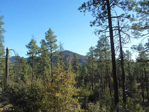
The Chavez Pass and Anderson Mesa area southeast of Flagstaff contains a large diversity of vegetation types including grasslands, pinyon-juniper savannas and woodlands, ponderosa pine forest and pockets of mixed conifer forest with firs. Dozens of ephemeral lakes scattered across the high plateau provide critical stopovers for migrating birds. The Anderson Mesa Important Bird Area is located here and is globally recognized as having critical habitat for many migrating species and, in particular, for Pinyon Jay. While the area of Anderson Mesa further to the north has been more heavily birded, the Chavez Pass area on the south end hasn’t received as much coverage. The ranges of species associated with areas further to the south, such as Montezuma Quail, extend into this area. This region is seeing increased use by recreationists and climate change is, as in other ponderosa pine and pinyon-juniper ecotones across Arizona, leading to vegetation type conversions that will likely have far-reaching ecological impacts.
Access Information
Forest Highway 3, more commonly referred to as Lake Mary Road, runs from Flagstaff to Highway 87 at Clint’s Well. This is the main access to the Chavez Pass area from the west and south. Highway 87, the highway that begins in the Phoenix area, passes through Payson and eventually ends in Winslow, is at the southern edge of this area. Access is also possible from the northeast via Interstate 40. The Meteor Crater road can be followed from I-40 to Chavez Pass. Note that most of this route traverses miles of dirt road through very remote country. The downloadable map available above, as well as the Coconino National Forest travel map, are essential for visiting this area. The Coconino National Forest travel map can be downloaded from Avenza and paper versions are available for purchase from the Forest Supervisor’s office in Flagstaff, as well as from many outdoor stores such as REI. Please be respectful of private land.
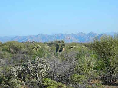
Hassayampa Plain (Maricopa Co.)
Description
The Hassayampa Plain is the dry floodplain of the Hassayampa River as it travels south to its confluence with the Gila River south of I-10. The focus of this area is between the White Tank and Belmont Mountains, and south of the Vulture Mountains. The Hassayampa Plain is known to have high densities of Bendire’s Thrasher and harbors a small, a remnant population of LeConte’s Thrashers, both species of conservation concern. Other at risk species present in this area include Elf and Burrowing Owls, and Gilded Flickers.
In parts of the White Tank Mountains that contain elephant trees (Bursera microphylla), Gray Vireos are known to overwinter and they may use well-vegetated desert washes during winter and migration. Migrant songbirds use desert washes and desert-scrub flats may attract raptors, sparrows, thrashers, and bluebirds in winter. For those looking for more rugged desert hiking, Belmont and Vulture Mountains, the west side of the White Tank Mountains, and the Hummingbird Springs and Big Horn Wilderness Areas should be up your alley! Much of the desert between the Hassayampa River and the White Tank Mountains is slated for urban development in the very near future, and the proposed Interstate-11 corridor may go through part of the Hassayampa Plain. If you’re wanting to contribute data on bird distribution before habitat in this area is lost, and that could help with future bird conservation, this is an area to spend time
in and document what’s there.
Access Information
The land on the Hassayampa Plain is a patchwork of BLM, State Trust (permit required), and private lands. Some of the private land has public throughways that can be driven on, including roads below transmission lines. Much of the private land off of Sun Valley Parkway is owned by various real estate holdings and will be developed in the near future for more planned communities. The western side of the White Tank Mountains is on State Trust land. See above for information on how to obtain a recreation permit for State Trust lands. The Belmont Mountains in the western part of the area are all on numbered BLM roads; contact the BLM Hassayampa Field Office to inquire about maps for numbered routes:
Santa Maria Mountains (Yavapai Co.)
Description
This low mountain range just northwest of Prescott contains a mix of vegetation types, including chaparral, pinyon-juniper woodland, ponderosa pine forest, and riparian woodland. The area includes two designated Wilderness Areas (Juniper Mesa and Apache Creek) within the Prescott National Forest. Birders have provided some recent coverage along Walnut Creek and Camp Wood road, but there is still much of this area to explore. Interesting finds so far have included northward range expansions of Gray Hawks and Dusky-capped Flycatchers, and a western extension for American Three-toed Woodpecker in the state. The area is dotted with springs, which should attract birds during years with adequate winter and summer precipitation. While most of the birding coverage has been in the summer breeding season, this area should be checked for fall and winter irruptive species such as jays, bluebirds, robins, thrushes, and finches too. Birding can be done from the road or on longer hikes off of forest roads, while those wanting a more rugged hiking experience may consider checking out trails into the two wilderness areas.
Access Information
The two main access routes are via Williamson Valley Rd. into Walnut Creek Rd., and the Camp Wood Rd., which are all maintained dirt roads. Some side roads may be rougher, but you can still explore the area by parking off to the side and walking along the forest roads or on national forest trails. Avoid dirt roads if recent rain or snow has fallen, as these roads may be inaccessible, you would risk getting your vehicle stuck, and you may mess up the road conditions further for others when it’s wet and muddy. There are parcels of private property and State Trust Land here, so please respect property boundaries. See the above section regarding annual permits for recreating on State Trust Lands.

Check out our eBird Gaps account stats page (you must be logged in to eBird to view).
Updated Friday, 08 June 2012
|
©2005
|
HOME | | | REPORT SIGHTINGS | | | PHOTOS | | | BIRDING | | | JOURNAL | | | ABOUT US | | | CHECKLISTS | | | AZ BIRD COMMITTEE | | | EVENTS | | | LINKS |