 |
 |
|||||||||||||||||||||
|
||||||||||||||||||||||
Arizona eBird Gaps
How to Participate?
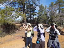 |
| photo by Eric Hough |
Create an eBird account if you do not have one already. Visit eBird and follow the steps to set up your account and read through the basics on how to choose locations, what types of bird counting to use, and how to count and estimate bird numbers:
Download the eBird app for both iPhone (iOS) and Android systems. This will allow you to accurately plot the location of your eBird checklist while in the field, using the coordinates from the GPS in your phone. This works even if you don’t have a cell signal, as it uses triangulation with satellites to determine your location. In order to do this, you need to allow the eBird app to access your location information in the settings.
Alternatively, you can take paper notes in the field and enter the data from your desktop after you get home. Be as accurate as possible in plotting the location of your checklist. When choosing the location, use the satellite or hybrid imagery to see landscape features and road names when you zoom in/out.
Download the Avanza app for both iPhone (iOS) and Android systems. To download copies of any of the Featured Gaps maps onto a mobile device, please go to your App Store or Play Store first and download the Avenza app. Please read these instructions on downloading and using the Avenza maps specific to the AZFO eBird Gaps project.
Check out the Featured Gaps page with maps and details for areas to focus on. While you are welcome to research other underbirded areas of the state on your own and submit checklists to eBird, the goal of this project is to make this easier for you by providing maps and access information to highlight different regions of Arizona. As we get more participation, we will increase how frequently we post new areas to explore!
Choose an eBird protocol on your checklist for the type of birding you will be doing. On the eBird app, you have the options of Traveling, Stationary, or Incidental. On the desktop view, you can also use Area Search if you are able to calculate the area that you surveyed. Please see below for definitions and examples of these types of counts, or visit eBird’s help page.
For the AZFO eBird Gaps project, we prefer participants to use either Traveling or Area Search. Please try to keep each checklist using Traveling count protocol to under 5 miles. It is also encouraged to use different checklists for nocturnal counts and when going between counties, different habitats, or different easily defined geographic locations. You can either use the coordinates generated by the eBird app for the location name, or create your own name to correspond to the specific location you birded (e.g. using names of roads, creeks, washes, mountains, etc.). If you are doing a Traveling count and head back the same way you came, you can either create a new checklist for the way back, or end the first checklist and only add on new species or counts that were higher for any given species, recalculating the duration of the checklist at the end; you should use only the one-way distance for the miles or kilometers covered though in the latter scenario.
Stationary counts may be used if you want to do a point count or ‘Big Sit’ style count at a particular spot. Scenarios may include:
Staking out a water feature, such as a reservoir or lake, a stream or river, livestock or wildlife tank (impoundment), or spring that may attract birds from surrounding drier habitats. Rivers and reservoirs attract water birds and swallows during migration.
Doing a hawk watch from an overlook along a mountain ridge, cliffs, or above a river or wash. Diurnal raptors and vultures use geographic features like ridges and vegetated drainages as landmarks while migrating.
If you notice a significant wave of migrants while you are in the field. This may pertain to migrants following riparian or xeroriparian vegetation along a river or ephemeral desert wash, or migrants foraging in vegetation along mountain ridgelines or drainages. Inclement weather can also cause mini ‘fallouts’ where migrants fly lower than normal or shelter in atypical habitat (e.g. shorebirds, swallows, and other songbirds).
Doing Breeding Bird Survey or Nightjar Survey style protocols, where you would be doing short duration point counts along stretches of road.
Incidental checklists can be used for birds seen or heard while driving between locations, where you did not spend time at the spot trying to detect all birds present (as you would during Stationary or Traveling counts).
Count birds and provide details if needed! As you go birding, you can either keep count of birds as you go, or estimate numbers afterwards. For estimating numbers including large flocks, it’s best and easiest to count in increments of 1s, 2s, 5s, 10s, 100s, 1000s, etc.
If it is during the breeding season for birds, you might consider using the Breeding Codes for each species if you witness behavior suggestive of breeding or nesting. This is where it is helpful to consult other resources, such as the Arizona Breeding Bird Atlas (Corman & Wise-Gervais 2005), in determining if the birds are expected to breed in a particular area or habitat, as many species are tied to particular vegetation associations. Just hearing a bird singing is not enough to use the “Singing Bird” breeding code…it’s having the knowledge of, for example, whether the Bewick’s Wren, Ruby-crowned Kinglet, or White-crowned Sparrow is just singing on its wintering grounds or during migration, versus singing in the appropriate breeding habitat and geographic area, and within the right season. If you are unsure whether to use a breeding code or not, it’s best not to, but you might type your observations in the details box for that species in your checklist for future reference.
If any species or counts get flagged as rare, please add details in the box for that species on what the bird you saw looked like (if rare for the region or season) or how you arrived at the count/estimate for the high count (i.e. “exact count” or “estimate, counted by 5s [or other interval]”). If the volunteer reviewer for that eBird region has any questions on the sighting, they should send you an email asking for more details. Taking photos or audio recordings can be helpful for documentation, which you can upload to your checklist after returning from the field.
Submit the checklist when you get back to cell service and remember to add photos or audio recordings to your checklist when you get home. This is especially important for any rare species flagged or for unusually high counts.
**Share your eBird checklist with the username “AZFO gaps”! This will help AZFO keep track of participation in this project and learn how better to refine and focus our goals!
Share any special observations or photos from the field with us on Facebook!
If you have any questions about the project or access information for the mapped areas, please send an email to azfo.gapsATgmail.com and for questions on using eBird, please visit their help page.

Check out our eBird Gaps account stats page (you must be logged in to eBird to view).
Updated Friday, 08 June 2012
|
©2005
|
HOME | | | REPORT SIGHTINGS | | | PHOTOS | | | BIRDING | | | JOURNAL | | | ABOUT US | | | CHECKLISTS | | | AZ BIRD COMMITTEE | | | EVENTS | | | LINKS |